
Surveying technology plays an important role in land development, construction, agriculture, and mapping projects. The accuracy of positioning data directly affects project results and daily operations. Reliable field information helps professionals make better decisions during different stages of a project.
When selecting surveying equipment, users need to consider factors such as positioning performance, compatibility, durability, and application requirements. A suitable receiver can help surveyors collect reliable field data and improve workflow efficiency while adapting to different working environments and project conditions.
This article explains the main factors to consider before choosing a GNSS receiver and introduces how EFIX supports surveying applications through its GNSS solutions. By understanding equipment features and practical needs, users can select positioning tools that better match their specific surveying tasks.
How a GNSS Receiver Supports Accurate Surveying Operations
Positioning accuracy is one of the first factors users should evaluate when choosing surveying equipment. Different projects require different accuracy levels. Construction layout, cadastral surveys, and mapping tasks may have different requirements for positioning stability and data reliability.
A GNSS receiver for surveying works by receiving signals from satellite systems such as GPS, GLONASS, Galileo, and BeiDou. Multi-constellation support allows receivers to access more satellite signals, which can help maintain positioning availability in different environments.
Signal tracking capability is also important during field operations. Areas with trees, buildings, or uneven terrain can affect satellite communication. A receiver with stable signal processing can provide more consistent data collection during complex working conditions.
Evaluating Connectivity and Data Management Features
Modern surveying equipment is not only about satellite signal reception. Connectivity functions also influence how efficiently field data can be collected and processed. Wireless communication, correction service support, and data transfer options are important features for professional users.
When selecting a GNSS receiver for surveying, users should check whether the equipment can work with common correction methods and surveying software. Flexible connection options make it easier to integrate the receiver into existing workflows.
Data management is another factor that should not be ignored. Surveyors often need to store, export, and process large amounts of positioning information. A practical system should support smooth data handling from field collection to office analysis.
Considering Durability and Working Environment
Surveying equipment is usually used outdoors, where conditions can change quickly. Dust, moisture, temperature changes, and accidental impacts may affect equipment performance. Therefore, durability is an important consideration before purchasing a receiver.
The working environment should guide the selection process. Equipment used in open fields may have different requirements from devices used near construction sites or urban areas. A suitable design can support stable operation during regular field activities.
Battery performance is also related to outdoor usability. Longer working time can reduce interruptions during surveying tasks. Users should consider how the equipment matches their daily operation schedules and project needs.
Reviewing Application Compatibility and Product Design
Different industries use GNSS technology for different purposes. Surveying, agriculture, and machine control applications may require different system configurations. Understanding the main application helps users select suitable equipment features.
For users looking for a GNSS receiver for surveying, compatibility with external devices and software is an important part of the decision process. A receiver that can connect with existing tools can reduce adjustment time and support smoother project implementation.
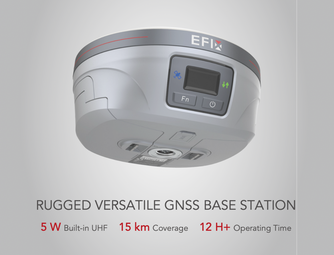
As a company focused on positioning technology, EFIX provides GNSS-related products designed for professional applications. Their eBase product is a GNSS base station that supports high-precision positioning tasks. The product is designed to provide correction data for applications that require accurate location information. Its role in surveying workflows is to support reliable positioning by working with compatible GNSS equipment.
Checking Support Services and Long-Term Usage Needs
Before choosing surveying equipment, users should also consider technical support and future usage requirements. Equipment updates, operation guidance, and maintenance services can influence the overall user experience.
A receiver may be used for many different projects over time. Therefore, users should think about whether the equipment can adapt to changing requirements. A practical selection should balance current needs with possible future applications.
EFIX develops positioning solutions that cover different professional scenarios. Their GNSS products focus on providing tools for users who need accurate positioning information in field operations. This approach helps users understand how GNSS technology can support different industries.
Conclusion
Choosing suitable surveying equipment requires careful evaluation of accuracy, connectivity, durability, and application compatibility. A clear understanding of project requirements helps users avoid selecting equipment that does not match their working conditions.
For professionals comparing different options, a GNSS receiver for surveying should be evaluated based on real working environments rather than only individual features. Reliable positioning, practical design, and suitable integration can influence the effectiveness of field operations.
With the development of digital surveying technology, GNSS solutions continue to support more industries. Companies such as EFIX provide related positioning products that help users apply satellite-based technology in professional workflows. Understanding key selection factors allows users to make more suitable decisions for their surveying projects.
